
Medium
engraving
Dimensions
380; 300
Rights
Public Domain
About this artwork
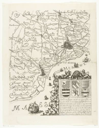
Kaart van Delfland. Boven in het midden het wapen van het Hoogheemraadschap Delfland en de gemeentewapens van de steden. Linksonder een windroos. Geheel bestaande uit negen bladen en zes tekstbladen: blad rechtsonder.
Art Historical Context
This 1612 engraving by Floris Balthasarsz. van Berckenrode forms the bottom-right sheet of a large, multi-part map of Delfland, a low-lying region in the Netherlands. Measuring 380 by 300 millimeters, the work belongs to a nine-sheet cartographic project accompanied by six text panels. At its center appear the coats of arms of the Hoogheemraadschap Delfland—the regional water board—and surrounding towns, while a decorative compass rose occupies the lower left corner. Such details blend practical navigation with civic symbolism. Created during the Dutch Golden Age, the map reflects the Netherlands’ growing emphasis on land reclamation and water management. Engraving was the preferred medium for disseminating accurate geographic information across a prosperous trading nation, allowing fine lines to capture dikes, canals, and property boundaries with remarkable precision. Berckenrode’s sheet thus served both administrative and decorative purposes, underscoring how cartography functioned as an art form that celebrated regional identity and technological progress. Today the print offers visitors a vivid glimpse into early-seventeenth-century Dutch society, where science, art, and governance intersected on paper.